Maryland Braces for Significant Snowfall: Winter Storm Warning Issued
The National Weather Service has escalated its advisory for Tuesday’s approaching storm in Maryland from a simple alert to a full-blown winter storm warning. After enjoying clear skies and sunshine on Monday, and a dry Tuesday morning, residents should prepare for a snowy evening. The winter storm watch, effective Tuesday, will persist into Wednesday, promising more snowfall across Maryland. This enhanced warning is set to start on Tuesday afternoon and will last through Wednesday morning, indicating the potential for significant snowfall.
As of Monday afternoon, the winter storm advisory covered Anne Arundel and Howard counties, the Baltimore metro area, as well as the D.C. suburbs, Southern Maryland, and the Eastern Shore. Meanwhile, the remainder of Central Maryland, stretching along the Pennsylvania border and into Western Maryland, is under a winter weather advisory during this period.
According to WBAL-TV 11 Meteorologist Tony Pann, computer models predict light snow beginning by mid-afternoon on Tuesday in the Baltimore metro. Chief Meteorologist Tom Tasselmyer anticipates heavier snow post-sunset, especially south of Baltimore, with the snowy conditions continuing through the night into Wednesday morning. The snowfall is expected to taper off by Wednesday morning, although a wintry mix might redevelop by the afternoon before transitioning into rain by the evening.
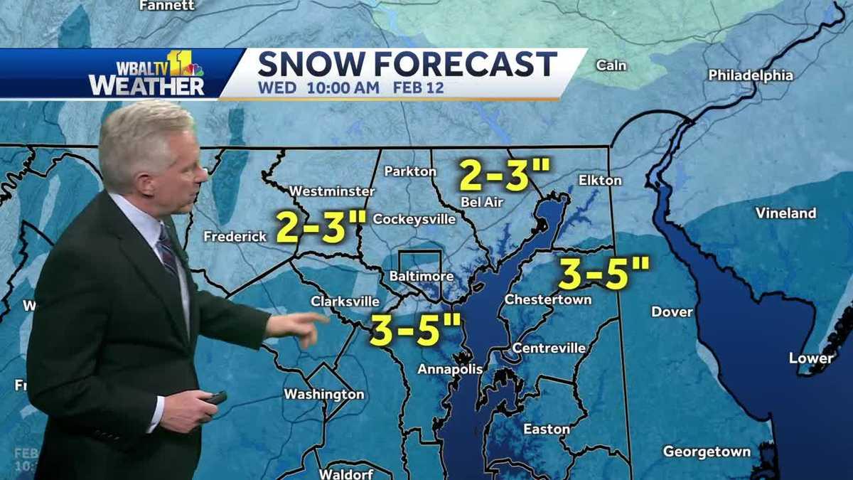
Baltimore could see snowfall accumulations of 2-3 inches, with 3-5 inches expected south of the city, where some areas may experience even higher amounts. In response, several Baltimore County school districts are planning early closures on Tuesday afternoon. Students in Anne Arundel County will switch to virtual learning on Tuesday, and Baltimore City has canceled all after-school activities.